Best Hiking Trails in Austin: Your Complete 2024 Guide
Austin's hiking scene offers everything from urban boardwalk strolls along Lady Bird Lake to hidden natural swimming holes and limestone canyon treks just minutes from downtown. Whether you're a beginner seeking an easy morning walk or an experienced hiker looking for a full-day backcountry adventure, the Austin area delivers with remarkable diversity. This comprehensive guide covers the essential trails, seasonal planning strategies, and practical tips to help you make the most of Central Texas outdoor recreation.
Why Austin is a Hiking Destination Worth Exploring
The Texas capital sits at a unique crossroads where the Hill Country meets East Texas pine forests, creating an ecological mosaic found nowhere else in the state. The Barton Creek Greenbelt cuts through the city's core, while McKinney Falls State Park lies just 13 miles southeast off US-183. Local favorites like the Hamilton Pool Preserve in Dripping Springs attract visitors from across the region to witness a 50-foot waterfall cascading into a jade-green natural pool surrounded by limestone cliffs.
Austin's trail network has expanded significantly over the past decade, with the Ann and Roy Butler Hike-and-Bike Trail now spanning over 10 miles around downtown and offering unobstructed views of the TX-360 Bridge and the Austin skyline. The trail system continues growing through partnerships between the City of Austin, Travis County, and Texas Parks & Wildlife Department.
Quick Comparison: Austin's Most Popular Hiking Trails
| Trail Name | Location | Distance | Difficulty | Pet-Friendly | Fee Required |
|---|---|---|---|---|---|
| Ann and Roy Butler Trail | Lady Bird Lake, Downtown | 10 miles | Easy | Yes (leashed) | No |
| Onion Creek Trail | McKinney Falls State Park, SE Austin | 3.7 miles | Easy | Yes | Yes (TPWD) |
| Hamilton Pool Preserve | Dripping Springs (approx. 30 mi W) | 1.9 miles | Moderate | No | Yes (advance reservation) |
| Slaughter Creek Loop | South Austin, near FM-1826 | 5.3 miles | Easy | No | No |
| Spicewood Valley Trail | Northwest Austin, near FM-620 | 2.5 miles | Easy | Yes | No |
| Barton Creek Greenbelt | Southwest Austin, multiple access points | 12+ miles total | Easy to Strenuous | Yes (leashed) | No |
Seasonal Guide: When to Hit Austin's Trails
Central Texas weather shapes your hiking experience dramatically throughout the year. Understanding seasonal conditions helps you plan safe, enjoyable outings.
Spring (March through May): Peak Hiking Season
Spring earns its reputation as Austin's premier hiking season. Wildflowers burst across the Hill Country, with bluebonnets painting roadsides along TX-71 and FM-3238. Temperatures range from 65-85°F, creating ideal conditions for full-day adventures. Spring creeks run freely after winter rains, transforming normally dry streambeds into rushing waterways along trails like the Barton Creek Greenbelt. The McKinney Falls area showcases particularly dramatic waterfall sightings during this period. Weekend trailheads fill early; arrive before 8am for parking at popular destinations.
Summer (June through August): Heat Management Critical
Summer demands respect. Austin temperatures regularly exceed 100°F, making midday hiking dangerous. The National Weather Service advises limiting outdoor activity during afternoon hours. Successful summer hiking means starting before 7am or waiting until 6pm, carrying more water than seems necessary (minimum one liter per hour), and choosing trails with creek access or shade cover. The Barton Creek Greenbelt offers creek crossings and shaded sections that make summer daytime hiking marginally safer. Watch for signs of heat exhaustion: dizziness, nausea, and cessation of sweating require immediate cooling and medical attention.
Fall (September through November): Second Prime Season
Fall temperatures cool to a comfortable 70-85°F range, and humidity drops from summer highs. September can still carry late-summer heat, but October through November offer perfect hiking conditions. Autumn color changes appear along the Onion Creek corridors and in the Lake Austin area. This season also brings clearer skies, making views from the Mount Bonnell overlook particularly spectacular during golden hour.
Winter (December through February): Mild Weather Advantage
Winter provides a hidden gem season for Austin hikers. Temperatures range from 40-65°F, allowing midday hiking that summer months prohibit. Trails see significantly fewer visitors, and the Lady Bird Lake boardwalk offers peaceful morning walks with fog rising off the water. While some creeks run low, the limestone outcrops and canyon views of the Hill Country remain accessible year-round. Winter hiking means layers—morning starts can feel cold, but temperatures often climb 20-30 degrees by midday.
Trail Safety Essentials for Austin Hikers
Austin's unique environment presents specific challenges that require preparation beyond typical hiking awareness.
Water and Hydration
Central Texas heat demands aggressive hydration strategies. Carry a minimum of one liter of water per hour during warmer months, regardless of the season. Summer hikes require doubling or tripling this amount. The Barton Creek Greenbelt provides water access points at several crossings, making it somewhat safer for summer hydration refills, but always carry more than you expect to need. Dehydration can creep up unexpectedly, especially for visitors from cooler climates.
Sun Exposure and Heat Stroke Prevention
The Texas sun is intense year-round. Wear broad-brimmed hats, UPF-rated clothing, and apply waterproof sunscreen. Many Austin trails lack tree cover, particularly in the eastern reaches of the Onion Creek trail system. Know heat stroke symptoms: hot dry skin, confusion, and loss of consciousness require immediate emergency response (call 911) while moving the victim to shade and applying cool water.
Wildlife and Terrain Awareness
Venomous snakes (copperheads, rattlesnakes) inhabit areas like McKinney Falls State Park and the Barton Creek Greenbelt. Stay on marked trails, watch where you step, and never reach into crevices or under rocks. Ticks appear year-round, particularly after rain; perform tick checks after every hike. The limestone terrain, while beautiful, features sharp edges and can be extremely slippery when wet.
Getting to Austin's Trailheads
Most major trailheads offer dedicated parking, though spots fill quickly on weekends at popular destinations.
Downtown and Central Access
The Lady Bird Lake trail system features multiple access points: the Lou Neff Point near the I-35 bridge, Zilker Metropolitan Park on the west bank, and Roy G. Guerrero Colorado River Park on the east side. MoPac Expressway (TX-1 Loop) provides access to the northern sections via Fm 2222 exits. Parking fills by 9am on spring weekends; consider the MetroRapid bus service or rideshare to avoid circling for spots.
State Parks and Preserves
McKinney Falls State Park (13 miles southeast, exit US-183 at TX-169) requires separate entrance fees collected by Texas Parks & Wildlife. Hamilton Pool Preserve requires advance reservations through the Travis County website, particularly during summer months when the jade-green pool becomes a swimming destination. Pace Bend Park on Lake Travis offers 5 miles of trails with cliff-jumping opportunities.
Family-Friendly Hiking in Austin
Austin's trail network offers excellent options for families with young children. The Ann and Roy Butler Hike-and-Bike Trail provides a completely flat, paved surface suitable for strollers and young walkers. The boardwalk sections offer interest without technical challenges. Zilker Botanical Garden trails connect to the greenbelt for families wanting shorter outings with botanical variety.
McKinney Falls State Park features the scenic Onion Creek water crossings that children find endlessly fascinating, plus the old mill ruins add historical interest. The park's campground allows overnight stays for families wanting extended outdoor experiences.
For families with older children interested in wildlife, the Wild Basin Wilderness Preserve near TX-360 offers guided nature programs and the chance to spot white-tailed deer, armadillos, and over 150 bird species documented in the preserve.
Hidden Gem Trails Worth the Extra Miles
Beyond the well-known destinations, Austin's surrounds hold trails that reward adventurers willing to explore.
Northwest Austin: Spicewood Valley
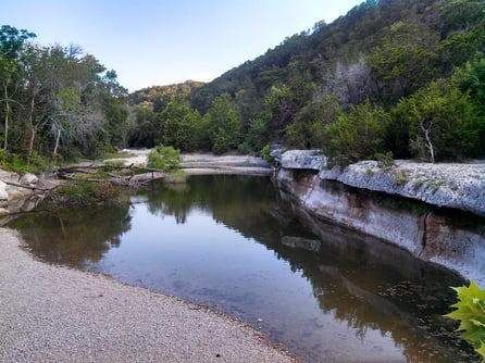
Located in northwest Austin off FM-620, the Spicewood Valley Trail spans 2.5 miles through a limestone canyon that remains remarkably unknown despite its proximity to growing residential areas. This pet-friendly route offers creek crossings, wildlife viewing, and the kind of solitude increasingly rare near Austin's core. The trail features gentle elevation changes through juniper-oak woodland, with wildflowers appearing in spring and summer.
South Austin: Slaughter Creek Trail
The Slaughter Creek Trail Loop in South Austin covers 5.3 miles through a mix of cedar breaks and creek bottomland. Access from the Slaughter Creek Trailhead off FM-1826 (also called Manchaca Road), this route offers both hiking and biking trails. The southern section features Slaughter Creek itself, where water levels permit wading during wetter periods. This trail provides an excellent introduction to Hill Country hiking without the crowds of more famous destinations.
Frequently Asked Questions About Austin Hiking Trails
What are the best easy hiking trails near downtown Austin?
The Ann and Roy Butler Hike-and-Bike Trail around Lady Bird Lake offers 10 miles of completely flat, paved path with stunning downtown skyline views. The boardwalk section near the TX-360 Bridge provides the iconic Austin skyline shots. For short walks, the Zilker Park section offers 2-3 mile options with minimal elevation gain.
Do I need reservations for Hamilton Pool Preserve?
Yes, Hamilton Pool Preserve requires advance reservations through Travis County's online booking system. Day passes sell out quickly, especially during summer months and weekends. The preserve limits daily visitors to protect the sensitive karst ecosystem. Arrive at your reserved time window; late arrivals may not be accommodated.
Are Austin's hiking trails pet-friendly?
Many trails allow leashed dogs, including the entire Lady Bird Lake trail system, the Barton Creek Greenbelt (leash required), and Spicewood Valley Trail. However, Hamilton Pool Preserve and Slaughter Creek Trail prohibit pets to protect sensitive wildlife habitat. Always carry waste bags and dispose properly.
What's the most scenic trail for photography in Austin?
The boardwalk section of the Ann and Roy Butler Trail offers the most recognizable Austin skyline shots, particularly during sunrise and the blue hour before sunset. For natural scenery, McKinney Falls State Park provides dramatic waterfall and creek photography opportunities, especially after rain. The Mount Bonnell overlook (accessible via West 3600 roads) offers panoramic lake views.
Can I hike Austin trails in summer?
Summer hiking requires careful planning and early timing. Start any hike before 7am to beat the worst heat, or hike after 6pm during civil twilight. Choose shaded trails like the Barton Creek Greenbelt where creek access allows cooling off. Carry more water than seems reasonable—at minimum two liters per person for a two-hour hike. Know the signs of heat illness and have an exit plan.
Which Austin trails offer backcountry camping?
McKinney Falls State Park offers designated camping areas near the creek and within the park boundaries. For more remote experiences, Colorado Bend State Park (approximately 90 miles northwest) features 26-mile backpacking loops with primitive camping. Pedernales Falls State Park (approx. 30 miles west via TX-71) provides backcountry camping with access to the Pedernales River.
What should I bring for a day hike in Austin?
Essential items include: minimum one liter water per person per hour, trail-appropriate footwear with grippy soles (limestone becomes extremely slippery when wet), sun protection (hat, sunscreen, sunglasses), a basic first aid kit, a charged mobile phone for emergencies, snacks or a light lunch for longer hikes, and a small flashlight or headlamp even for daytime hikes (unexpected time delays happen). A map or downloaded trail guide helps since cell service can be unreliable in some areas.
Plan Your Austin Hiking Adventure Today
Austin's trail network offers remarkable diversity within an easy drive of downtown. From the accessible urban boardwalk experience along Lady Bird Lake to the rugged limestone beauty of Hamilton Pool Preserve, there's a trail suited to every fitness level and interest. The key to enjoying Austin hiking lies in respecting the Texas heat, carrying adequate water, and timing your visits to match seasonal conditions.
Start with the Ann and Roy Butler Trail for an introduction to Austin's outdoor culture, then venture to McKinney Falls State Park for a taste of Hill Country terrain. When you crave something special, secure a reservation for Hamilton Pool Preserve or explore the hidden canyon of Spicewood Valley. Every trail offers its own rewards— creek crossings that cool overheated feet, views that capture the Austin skyline, and moments of solitude that remind you why getting outdoors matters.
Grab your water bottle, apply the sunscreen, and discover why locals consider their trail system one of the city's greatest assets. The best hike in Austin is the one you're about to take.